Friday, December 23, 2016

Researchers estimate 10,000 metric tons of plastic enter Great Lakes every year

A new study by Rochester Institute of Technology that inventories and tracks high concentrations of plastic in the Great Lakes could help inform cleanup efforts and target pollution prevention.
Researchers found that nearly 10,000 metric tons -- or 22 millionMarine Pollution Bulletin.
pounds -- of plastic debris enter the Great Lakes every year from the United States and Canada. Matthew Hoffman, assistant professor in RIT's School of Mathematical Sciences, is the lead author of "Inventory and transport of plastic debris in the Laurentian Great Lakes," which will run in an upcoming issue of 
"This study is the first picture of the true scale of plastic pollution in the Great Lakes," Hoffman said. Hoffman used computer simulations to follow the volume of plastic debris moving across state and international boundaries -- from Illinois to Michigan and from Canada to the United States.
Earlier studies estimate 40,000 to 110,000 metric tons of plastics enter the oceans along the U.S. coastline, Hoffman said.
In their study, Hoffman and co-author Eric Hittinger, assistant professor of public policy at RIT, report that half of the plastic pollution entering the Great Lakes -- 5,000 metrics tons per year -- goes into Lake Michigan, followed by Lake Erie with 2,500 metric tons and Lake Ontario with 1,400 metric tons. Lake Huron receives 600 metric tons of plastic and Lake Superior, 32 metric tons per year.
Estimates of surface microplastics entering the lakes each year show 4.41 metric tons in Lake Erie, 1.44 metric tons in Lake Huron and .0211 metric tons in Lake Superior.
Plastic pollution in Lake Michigan is approximately the equivalent of 100 Olympic-sized pools full of plastic bottles dumped into the lake every year, Hittinger said, whereas the yearly amount of plastic in Lake Ontario equates to 28 Olympic-sized pools full of plastic bottles.
Prior observational studies measured localized concentrations of plastic pollution in the open water, tributaries and along the shorelines. The new study applied mathematical modeling for the first time to extend the scope of the problem over time and spatial scales.
The inventory gives full mass estimates on the entire connected lake system and maps plastic debris moving between lakes and across interstate and international borders. The results provide environmentally realistic concentrations of plastic in the Great Lakes.
Findings of the study show debris travels differently in the Great Lakes than in the ocean. Instead of the floating "garbage patches" found in the ocean, plastic in the Great Lakes are carried by persistent winds and lake currents to the shore -- often washing up in another state or country, Hoffman said.
Plastic accounts for approximately 80 percent of the litter on the shorelines of the Great Lakes. The study quantifies dense plastic that quickly sinks and surface plastics like microbeads, fragments and pellets, plastic line and Styrofoam, which could be consumed by wildlife and potentially enter the food chain.
Major population centers are the primary sources of plastic pollution in the Great Lake system, with Chicago, Toronto, Cleveland and Detroit releasing more plastic particles than accumulate on their shorelines.
"Most of the particles from Chicago and Milwaukee end up accumulating on the eastern shores of Lake Michigan, while the particles from Detroit and Cleveland end up along the southern coast of the eastern basin of Lake Erie," Hoffman said. "Particles released from Toronto appear to accumulate on the southern coast of Lake Ontario, including around Rochester and Sodus Bay."
Estimates of plastic pollution throughout the Great Lakes were derived using population dynamics within 100 kilometers, or 62 miles, of the shores and hydrodynamic modeling to simulate the distribution of plastic debris throughout the Great Lakes from 2009 to 2014. Data from the National Oceanic and Atmospheric Administration Great Lakes Coastal Forecast System were used to simulate currents transporting plastic debris throughout the lake system.

Story Source:
Materials provided by Rochester Institute of Technology. Original written by Susan Gawlowicz. Note: Content may be edited for style and length.

Thursday, December 15, 2016

तूफान के निशान

देश ने समुद्री लहरों का सबसे भयानक कोप दिसंबर 2004 में देखा, जब सुनामी ने
दक्षिण भारत के साथ-साथ श्रीलंका और इंडोनेशिया पर भी कहर बरपाया था।
प्राकृतिक आपदा को रोका नहीं जा सकता। पर उसके कहर को कम जरूर किया जा सकता है, और जाहिर है, यह निर्णायक रूप से पूर्व-सूचना तथा पूर्व-तैयारी पर निर्भर करता है। ‘वरदा’ तूफान से, पूर्व के अनुभवों की तुलना में, जान-माल का कम नुकसान हुआ, तो इसका बड़ा कारण चेतावनी प्रणाली का विकास है। तूफान के आने की सूचना समय से लोगों तक पहुंचा दी गई थी और सरकारों ने भी अपनी तैयारी कर ली थी। सोमवार को दोपहर बाद जब वरदा नामक समुद्री तूफान तमिलनाडु के तट से टकराया, उसके पहले राज्य सरकार ने कोई दस हजार लोगों को तटीय क्षेत्र से हटा कर सुरक्षित स्थानों पर पहुंचा दिया था। इसी तरह आंध्र प्रदेश की सरकार ने भी हजारों लोगों को तटीय क्षेत्र से दूर पहुंचा दिया था। मछुआरों समेत तटीय इलाकों में रहने वाले सारे लोगों को तूफान के बारे में आगाह कर दिया गया था। केंद्रीय आपदा रक्षक बल के कई दस्तों और सेना की कई टुकड़ियों को आपात-सहायता के लिए पहले ही बुला लिया गया था। अभी तक तमिलनाडु और आंध्र प्रदेश में तूफान के चलते कुल मिलाकर दस लोगों के मारे जाने की खबर है। क्या पता यह तादाद कहीं ज्यादा होती, अगर वरदा से निपटने की पूर्व-तैयारी न हो पाती।
हाल के इतिहास में जिस सबसे भयंकर चक्रवात की याद लोगों को है वह 1999 में ओड़िशा में आया था। जब वह चक्रवात जगतसिंहपुर जिले के पारादीप बंदरगाह से टकराया तो उसकी गति करीब ढाई सौ किलोमीटर प्रतिघंटा थी। उस तूफान ने भयावह तबाही मचाई थी। हजारों लोग मारे गए और लाखोें घर उजड़ गए थे। उसके मुकाबले वरदा की रफ्तार काफी कम थी, सवा सौ से डेढ़ सौ किलोमीटर के बीच। पर जान-माल का नुकसान अपेक्षया कम हुआ तो इसकी वजह तूफान की गति कम होने के अलावा बरती गई सतर्कता भी थी। ओड़िशा के चक्रवाती तूफान के बाद देश ने समुद्री लहरों का सबसे भयानक कोप दिसंबर 2004 में देखा, जब सुनामी ने दक्षिण भारत के साथ-साथ श्रीलंका और इंडोनेशिया पर भी कहर बरपाया था। उसी के बाद चेतावनी प्रणाली विकसित करने पर तेजी से काम चला। फिर, अंतरिक्ष कार्यक्रम में हुई प्रगति से इसमें और मदद मिली। अब मौसम संबंधी भविष्यवाणियां पहले से ज्यादा प्रामाणिक होने लगी हैं। चक्रवाती तूफान के साथ अक्सर भारी बारिश भी होती है। तूफान, तेज हवाओं और भारी बारिश ने चेन्नई तथा चित्तूर समेत तमिलनाडु और आंध्र के कई तटीय जिलों में बहुत सारे पेड़ और मकान ढहा दिए हैं।
यों चेन्नई हवाई अड्डे से विमानों के उड़ान भरने का क्रम फिर से चालू हो गया है, और गिरे हुए पेड़ हटा कर कई प्रमुख रास्ते फिर से आवागमन के लिए खोल दिए गए हैं। पर कई रास्ते अब भी बंद हैं और कुछ इलाकों में बिजली की आपूर्ति फिलहाल ठप है। सामान्य स्थिति बहाल होने में अभी वक्त लग सकता है। वरदा की पूर्व सूचना मिल जाने और बचाव की पूर्व तैयारी हो जाने पर लोगों ने राहत की सांस ली है। पर तूफान की मारकता और कम हो सकती थी अगर समुद्रतटीय वनों को नष्ट नहीं किया गया होता। सुनामी के समय यह देखा गया था कि जहां मैंग्रोव वन थे वहां कम तबाही हुई। लेकिन विडंबना यह है कि सुनामी के भीषण अनुभव के बाद भी मैंग्रोव वनों को बचाने का कोई खास प्रयास शुरू नहीं हो पाया, और यह कोताही अब भी जारी है।

Saturday, December 10, 2016

Permian Period: Climate, Animals & Plants

The Permian Period was the final period of the Paleozoic Era. Lasting from 299 million to 251 million years ago, it followed the Carboniferous Period and preceded the Triassic Period. By the early Permian, the two great continents of the Paleozoic, Gondwana and Euramerica, had collided to form the supercontinent Pangaea. Pangaea was shaped like a thickened letter “C.” The top curve of the “C” consisted of landmasses that would later become modern Europe and Asia. North and South America formed the curved back of the “C” with Africa inside the curve. India, Australia and Antarctica made up the low curve. Inside the “C” was the Tethys Ocean, and most of the rest of Earth was the Panthalassic Ocean. Because Pangaea was so immense, the interior portions of the continent had a much cooler, drier climate than had existed in the Carboniferous.

Marine life
Little is known about the huge Panthalassic Ocean, as there is little exposed fossil evidence available. Fossils of the shallower coastal waters around the Pangaea continental shelf indicate that reefs were large and diverse ecosystems with numerous sponge and coral species. Ammonites, similar to the modern nautilus, were common, as were brachiopods. The lobe-finned and spiny fishes that gave rise to the amphibians of the Carboniferous were being replaced by true bony fish. Sharks and rays continued in abundance.
Plants
On land, the giant swamp forests of the Carboniferous began to dry out. The mossy plants that depended on spores for reproduction were being replaced by the first seed-bearing plants, the gymnosperms. Gymnosperms are vascular plants, able to transport water internally. Gymnosperms have exposed seeds that develop on the scales of cones and are fertilized when pollen sifts down and lands directly on the seed. Today’s conifers are gymnosperms, as are the short palm like cycads and the gingko.

Insects
Arthropods continued to diversify during the Permian Period to fill the niches opened up by the more variable climate. True bugs, with mouthparts modified for piercing and sucking plant materials, evolved during the Permian. Other new groups included the cicadas and beetles.
Land animals
Two important groups of animals dominated the Permian landscape: Synapsids and Sauropsids. Synapsids had skulls with a single temporal opening and are thought to be the lineage that eventually led to mammals. Sauropsids had two skull openings and were the ancestors of the reptiles, including dinosaurs and birds. 
In the early Permian, it appeared that the Synapsids were to be the dominant group of land animals. The group was highly diversified. The earliest, most primitive Synapsids were the Pelycosaurs, which included an apex predator, a genus known as Dimetrodon. This animal had a lizard-like body and a large bony “sail” fin on its back that was probably used for thermoregulation. Despite its lizard-like appearance, recent discoveries have concluded that Dimetrodon skulls, jaws and teeth are closer to mammal skulls than to reptiles. Another genus of Synapsids, Lystrosaurus, was a small herbivore — about 3 feet long (almost 1 meter) — that looked something like a cross between a lizard and a hippopotamus. It had a flat face with two tusks and the typical reptilian stance with legs angled away from the body.
In the late Permian, Pelycosaurs were succeeded by a new lineage known as Therapsids. These animals were much closer to mammals. Their legs were under their bodies, giving them the more upright stance typical of quadruped mammals. They had more powerful jaws and more tooth differentiation. Fossil skulls show evidence of whiskers, which indicates that some species had fur and were endothermic. The Cynodont (“dog-toothed”) group included species that hunted in organized packs. Cynodonts are considered to be the ancestors of all modern mammals.
At the end of the Permian, the largest Synapsids became extinct, leaving many ecological niches open. The second group of land animals, the Sauropsid group, weathered the Permian Extinction more successfully and rapidly diversified to fill them. The Sauropsid lineage gave rise to the dinosaurs that would dominate the Mesozoic Era.
The Great Dying
The Permian Period ended with the greatest mass extinction event in Earth’s history. In a blink of Geologic Time — in as little as 100,000 years — the majority of living species on the planet were wiped out of existence.  Scientists estimate that more than 95 percent of marine species became extinct and more than 70 percent of land animals. Fossil beds in the Italian Alps show that plants were hit just as hard as animal species. Fossils from the late Permian show that huge conifer forests blanketed the region. These strata are followed by early Triassic fossils that show few signs of plants being present but instead are filled with fossil remnants of fungi that probably proliferated on a glut of decaying trees.

Scientists are unclear about what caused the mass extinction. Some point to evidence of catastrophic volcanic activity in Siberia and China (areas in the northern part of the “C” shaped Pangaea). This series of massive eruptions would have initially caused a rapid cooling of global temperatures leading to increased glaciations. This “nuclear winter” would have led to the demise of photosynthetic organisms, the basis of most food chains. Lowered sea levels and volcanic fallout would account for the evidence of much higher levels of carbon dioxide in the oceans, which may have led to the collapse of marine ecosystems. Other scientists point to indications of a massive asteroid impacting the southernmost tip of the “C” in what is now Australia. Whatever the cause, the Great Dying closed the Paleozoic Era.

Tetrapods: Natural Antacid Helped Early Land Creatures Breathe

The earliest creatures to crawl out of the water onto land may have concocted antacids out of their own bones, a clever innovation that would’ve let the animals breathe, researchers now find.
The earliest tetrapods, or four-limbed creatures, made their first evolutionary forays onto land about 370 million years ago. Breathing air came with challenges, though. A major one was getting rid of the air’s carbon dioxide, which, when it builds up, reacts with water in the body and forms an acid.
Now, growing evidence in modern reptiles suggests that bones that grew within the skin of early tetrapods may have acted as a natural antacid by releasing their neutralizing chemicals into the bloodstream. The result would have bought the creatures time to spend on land before they had to head back to the water to rid themselves of excess carbon dioxide.
The skeleton of Eryops, one of the earliest land-walking tetrapods.Credit: © Christine M. Janis
 “Now we know that dermal bone can do this and it’s something we didn’t know before, that gives us a basis that maybe this is why tetrapods had this feature, which previously we didn’t have a good explanation for,” study researcher Christine Janis, a paleontologist at Brown University, told LiveScience. “It’s the discovery of this new feature of the physiology of these living animals that lets us go back [in time].”
First on land
So let’s rewind the clock: The first tetrapods evolved from fish in the Devonian period, which spanned from about 416 million years ago to 359 million years ago. These early tetrapods had broad faces, not unlike frogs, and rather immobile ribcages. That means they wouldn’t have been able to get rid of extra carbon dioxide by breathing quickly, as humans and other mammals do with their longer snouts and flexible ribcages. Nor were the tetrapods small enough to exchange carbon dioxide and oxygen via their skin, as modern amphibians do.
What tetrapods did have was complex “dermal bone,” or bone that forms from connective tissue in the skin instead of from cartilage like the long bones of the arm or leg.The concept of skin bone may seem strange, but it’s very common: The human skull, for example, is a dermal bone.
Early tetrapod bone showed many pits and furrows, indicating lots of blood supply, Janis said. Her colleagues, including paper co-author and biologist Daniel Warren of Saint Louis University, had found another piece of the puzzle: In modern turtles and alligators, this dermal bone helps the reptiles tolerate carbon dioxide buildup when they’re under water, unable to breathe.
Bone breathing
Tetrapods would have the opposite problem, Janis realized: They’d be able to release carbon dioxide through their skin while in the water, since their skin was more permeable than an alligator’s tough hide. But out on land, they’d need another means of release. It seemed very possible that tetrapods could have used their complex dermal bones as a storage unit for calcium and other acid-neutralizing minerals, releasing them as needed when body acid levels got too high, Janis said.
To test the idea, the researchers analyzed the skeletons of tetrapods. As you might expect, the tetrapods known by the skeletons to spend more time out of the water had the most complex dermal bones. The evolutionary history of the animal supports the hypothesis, as well.
“When [the dermal bone] gets lost, it gets lost in the lineage leading to modern reptiles when they start getting more mobile ribs,” Janis said.
She and her colleagues reported their work Tuesday (April 24) in the journal Proceedings of the Royal Society B.
End of the early tetrapods
While the evidence is consistent with Janis’ theory, there’s no proof yet that tetrapods really used their bones in this way. The next step, Janis said, will be to look for chemical or other clues in modern reptiles who use their bones as antacid. If any telltale signs are established, researchers can then hunt for the same signals in ancient tetrapods.
The terrestrial tetrapods studied by Janis and her colleagues went extinct during the Permian period 299 million to 251 million years ago. It was a changing world, Janis said, and atmospheric carbon dioxide was increasing. It’s possible that tetrapods’ bone-dependent breathing wasn’t as effective in this new atmosphere.

“Who knows?” Janis asked. “I think the point to make is that this was probably a perfectly good way to live for awhile — millions of years — but in the end, there were things that had figured out better ways of how to get rid of carbon dioxide.”

Tuesday, December 6, 2016

Forest rights and wrongs

Social activists and wildlife groups must acknowledge that no rights can be championed, nor wildlife saved, if the forests at the centre of the tussle vanish
The situation is equally distressful in states such as Maharashtra, Jharkhand, Chhattisgarh, Madhya Pradesh, Bihar, Orissa and Andhra Pradesh.
Soon after daybreak, driving through the forests of Sonitpur district in Assam in late 2005 we made a quick U-turn when a herd of around 15-20 elephants, young ones in tow, emerged from the forest to forage right next to the road leading to the fishing camp at the Nameri Tiger Reserve. The night before, we watched as elephants raided paddy stocks in a village near Balipara, unafraid of the mashaals (fire torches), drums and yells of the distressed villagers. Even as we turned, the matriarch followed our vehicle for 20 metres or so, trumpeting protectively from around 30 metres to make sure we got her message loud and clear.
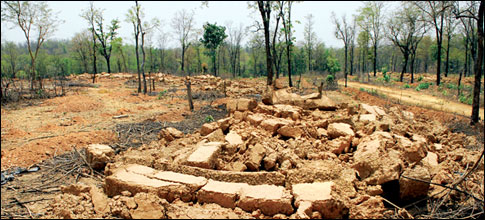
I know this part of India well and before my eyes, I have seen some of India’s most precious forests sacrificed to satiate political expediency using mistaken notions of tribal rights as a fig leaf to exchange land for votes. On a site visit to the same area 10 years later, I found myself speechless at the sheer destruction. In a decade, virtually the entire standing forest on the right bank of the Jiya Bharoli river had vanished. In its place were sparse mustard fields and scattered tree stumps that spoke of once-tall hardwoods whose trunk girth would have been three or four metres at the very least.
Similar stories unfold across vast areas of Sonitpur. We had predicted such disaster when the Forest Rights Bill was being debated way back in 2004-05. We asked, at the very least, a consensus be arrived at that individual rights not be included. A leading NGO, Kalpavriksh, amongst the most vociferous supporters of the flawed FRA, agreed with us in principle but went forward with other groups who threw such suggestions to the wind. Today, much too late, Kalpavriksh agrees that a site-specific amendment to Section 3 (1) of the Forest Rights Act (FRA), 2006, should have been made in Sonitpur to roll back the 2005 cut-off date to 1980, “in consonance with the Forest Conservation Act.” Subsequent to that admission, no further action was taken.
As we have seen happen time and again with urban slum rehabilitation and regularisation schemes, the horse had bolted. The barn door was never shut. What ails the FRA?
To begin with, the Act was intended only for tribal communities, but this was later extended to all forest “dwellers”. Second, individual rights trumped community rights which is evident from the statistics taken from the website of the ministry of tribal affairs from the report on FRA implementation. According to these statistics, people are predictably keen to claim individual rights as this enables them to encash real estate and other financial opportunities. Third, no time limit was definitively set. Had a cut-off date been effectively applied, we would not be in a position where even today “deforest, encroach and claim rights” continue unabated because gram sabhas would have finalised all rights within two years. And the date was 1980 in the first version of the bill.
Here is what the learned Supreme Court judges had to say in an order passed in response to Writ Petition(s)(Civil) No(s) 109/2008 and 50/2008.
“Mr Shyam Divan, learned senior counsel for the petitioner placed before us certain statistical data which indicates that as on September 30, 2015, approximately 44 lakh claims for recognition of the rights under the above-mentioned Act and grant of pattas came to be filed before the authorities competent to deal with those claims in various states out of which some of the claims were accepted and some were rejected. From the information placed before this court by the petitioners, it appears, approximately 20.5 lakh claims were rejected in the above-mentioned 44 lakh claims. Obviously, a claim in the context of the above-mentioned Act is based on an assertion that a claimant has been in possession of a certain parcel of land located in the forest areas. If the claim is found to be not tenable by the competent authority, the result would be that the claimant is not entitled for the grant of any patta or any other right under the Act but such a claimant is also either required to be evicted from that parcel of land or some other action is to be taken in accordance with law.”
Nevertheless, encroachers are not being evicted even after their claims have been rejected. What is more, most lands allotted are unfit for agriculture, condemning claimants to work as landless labour on the properties of richer landholders. The allotment of such lands means that the tribal families have to survive on sustenance farming without access to water, sanitation, health, education and medical facilities.
Even today, the cutting of trees continues. None of the cutting was or is legal. The tribals never had and still do not have title to the land. The elephant herds have vanished, but every once in a while, they return to raid crops. As many as 30 were poisoned in Sonitpur by angry farmers. Neither humans nor elephants are safe any longer. The Kameng-Sonitpur Elephant Reserve (KSER) offers refuge to elephants, in a small measure, but almost daily, as a direct result of human interventions, reports of “wild elephant herds creating havoc in Sonitpur,” appear in the media.
The situation is equally distressful in states such as Maharashtra, Jharkhand, Chhattisgarh, Madhya Pradesh, Bihar, Orissa and Andhra Pradesh. Here, too, in order to grow food on forestlands, locals were encouraged to deforest areas with political patronage. The objective is achieved by burning trees and ground vegetation, then planting food crops on the ash-fertilised remains. But, because the vast bulk of the forest nutrients are quickly washed or blown away, such farms are incapable of offering anything more than borderline livelihoods to farmers. This is precisely what gave rise to “marginal farming”, coined by economists to describe millions condemned to penury. Far from creating self-sufficiency, this has ended up eroding India’s food security, in part because downstream farms find themselves deprived of the flood, drought-control and nutrient-spread gifted by upstream forests.
As I write, the discussion seems Daliesque. The FRA provides a 90-day limit for filing claims. The Act was passed in 2005 (Rules in 2007). Can we seriously be discussing new claims even today? Surely we should collectively agree that no limits be allowed or extended under any circumstances? Remember, that our protected area network barely covers three per cent of our land and acts as an insurance against climate change, floods and droughts. Under no circumstances should such lands be open to the claim of any private rights whatsoever. In fact, it is vital that the long-pending rules to define Critical Wildlife Habitats be framed without further delay and that those deemed to be encroachers vacate such biodiverse lands.
Social activists and wildlife groups must both accept that no rights can be championed, nor wildlife saved, if the forests at the centre of the tussle vanish. Social activists talk of “harmonious co-existence”. But I ask — can 6,000 people live in harmony in 600 sq km with 60 tigers and over 600 elephants with the nearest market for forest produce being six km away? Given that the FRA is a reality and without going into the merits or demerits of the legislation itself, I wonder whether it might be possible for those living next to forests to form cooperatives with the singular purpose of restoring eco-systems back to health on their own lands. This may be easier said than done, but it is possible if a basket of benefits can be channelled to communities that opt for eco-system farming, instead of bajra, wheat or paddy. If this is achieved, the answer to the rhetorical question “Can the Forest Rights and Wildlife (Protection) Acts be friends?” might well be “Yes!”. But I am not holding my breath.

The writer is editor, ‘Sanctuary’ magazine

Wednesday, November 30, 2016

FOREST FIRES

Forest fires are an annual occurrence in Uttarakhand, and Himachal Pradesh. Over 4,500 hectares have been affected in Himachal Pradesh, some 40% more than the 3,185 hectares in Uttarakhand. The latter state has seen 1,470 incidents of fire so far — 803 (affecting 1,413.58 ha) of which were in the Garhwal region, 463 (1,076.21 ha) in Kumaon, and 204 (695.65 ha) in wildlife zones.
Nature of fire
It is very difficult to actually know how the fire started. But at least with the circumstantial evidences it is clear that there was lack of preventive measures and the preparedness was low with a weak action plan.
Forest fires as Natural Event
As a natural event Forest fire in Uttrakhand is a common phenomenon during the summer season. It is so mainly due to the presence of Chir pine trees. These trees heavily shed the highly inflammable dry Chir pine needles which acts like a fuel for combustion.
As a natural event wildfires are sometimes a natural process, and help forests by promoting flowering, branching and seedling establishment. fires that are limited to the surface may help in the natural regeneration of forests. The heating of the soil may result in helpful microbial activity, and hasten decaying processes that are useful for the vegetation.

Forest fires are a natural phenomenon and are bound to happen periodically. Some of the contributing factors are, built up of highly inflammable Chir Pine dead leaves, poor hydrological health, increasing impact of temperature increases, increasing pressure on the forests due to increasing human activity in the vicinity and repeated drought conditions.

Tuesday, November 29, 2016

INDIA- CHALLENGES OF EXTERNAL SECURITY

1.      WHAT IS EXTERNAL SECURITY
External Security refers to any threat that a country, a nation, a State or a nation-State perceives to its identity, its economy and its components, its stability, its borders and its population and in particular the feel of the people, their mental and physical health as well as to its social, technological and industrial infrastructure.  The threat can be perceived which has not been negated and real whose solution doesn’t seem to be materializing.
A country is almost always in a state of threat to its external security, and it is perennially in a process of negating these threats through diplomacy, alliances, geostrategies, etc.
2.     
INDIA’S EXTERNAL SECURITY CHALLENGES
The threat that India faces externally comprises of soft threats that affects
a.       the mindset of the people, such as a colonial mindset, and being unaware of the loss of its own identity
b.      the health of the people both mental and physical
c.       the threats to country’s economy like its gradual sabotage, by eating into market and also with the help of currency counterfeits, etc.
d.      the susceptibility of the country towards cyber attacks, cyber warfare warfare information manipulation and electronic warfare.
At the same time, India really faces some challenges on its external front some of it on its borders both land borders and maritime borders, its territories and through some military actions and its plan. These challenges include
a.       Existence and Opening of a two war front, if India safeguards itself against any nefarious designs of Pakistan to thwart and to crush country destabilizing threats of terrorism emanating from that region.
b.      The nuclear Threat emanating from both of its neighbors
c.       China Pakistan Networking
d.      Threats to Arunachal Pradesh and Siliguri corridor, and
e.       Maritime threats
India in reality faces all these threats, and there is no country in the world that actually faces threats of such dimension and such diversity with little to protect itself either from getting supported by the citizens of India and its psyche and or structure of its economy or even its defense preparedness.
India is the only country in the world that faces two nuclear arms loaded countries, one going insanely jealous and other lusting for its territory and people.
While all the threats are real and they exist, the emphasis of this chapter is mostly on the geostrategic perspective.

Multiple Challenges

In considering India’s external security the country’s policy makers have to bear in mind the economic backwardness and political instabilities of its smaller neighbors, the continued inimical relations that Pakistan has maintained with India. It has used terrorism as an instrument of foreign policy and as a force equalizer. India has to contend with the intentions of a powerful China that would seek to be the paramount power in Asia. External security would demand assessment of conventional military threats but in addition, terrorism, energy security, environmental degradation, demographic changes and access to natural resources including water and markets are the new factors. The nature of threats that emanate from the weakness of the smaller countries and those from the intentions of the bigger countries, China and Pakistan, are different and need different responses.

Cross-border threats

Most external threats emanate from an unsettled boundary dispute with China that has been forced on India and ongoing cross-border jihadi terrorism in J&K sponsored terrorism, supported by ISI and Pakistan-based Islamist fundamentalist organizations like Lashkar-e-Taiba and Jaish-e-Mohammad who, in turn, are inextricably linked with international jihadi groups like Taliban and Al Qaida.
Threat from Bangladesh assumes serious dimensions since it became a base for northeast insurgent groups like ULFA and Naga factions. Of late, it has also been serving as a conduit for ISI sponsored infiltration of terrorists along India and Bangladesh’s porous border.
To cap it, nuclear threats from neighboring states and from jihadi groups have the potential of using nuclear weapons in the foreseeable future, significant being China-Pakistan nuclear nexus.

                The Smaller Neighbours

A billion Indians, with enough problems of their own, thus live in a troubled part of a troubled planet. They live in an era of exploding expectations with limited resources and in economies of shortages across the entire South Asian region. The region continues to remain economically backward and politically unstable. Pakistan and Bangladesh, two of India’s most populous neighbours, are rapidly slipping into religious obscurantism. India will continue to face demanding challenges from its neighbours.
These are Nepal’s continuing domestic turmoil as it struggles to introduce democracy in the midst of a violent campaign led by the radical left wing ‘Maoists”; Bangladesh’s recession into a thinly veiled military regime after its troubled experience with democracy and slide into Talibanisation; and, Sri Lanka’s unending fratricidal war arising from the inability of the Sinhala majority to reconcile to the demands of an increasingly violent Tamil minority. Myanmar, with whom India has a long land frontier, has largely been an aloof and distant neighbour although there are signs of a thaw in the midst of fears that China may have become the relevant power in that country. A little further away but strategically relevant to India in the context of Pakistan and access to Central Asia, is Afghanistan which continues to slide into unending chaos.
The largest Muslim concentration in the world, about 450 to 460 million live in India, Pakistan and Bangladesh. Of these, about one third is in India. This makes them the largest number of Muslims living in a democratic set up for the longest time, any where in the world today. The rest have been under an increasing influence of dictatorships and Islamic radicalism at a time when state policies have weakened liberal societies while an anti-American sentiment has grown sharply. The challenge here for India is to keep its own Muslims immune from external influences where attempts are undoubtedly being made not only to suborn them but also simultaneously, to provoke a Hindu backlash.
India cannot help its size or strength and has to live with the title of a regional hegemon or even a bully at times accused of arrogance and intrusiveness when trying to help or being haughty and indifferent when trying to stay away. India baiting thus is common in Bangladesh, Pakistan and Nepal. It is perhaps natural that some of them seek comfort wit the distant power against the local power. Some of the neighbours do not wish to share in the prospects of mutual prosperity that India might offer but are willing to share poverty. These countries seek their own security by isolating themselves from India defying the logic of geography.
Consequently, countries of the sub-continent are unable to maximise economic complementarities and opportunities to the extent that they hardly trade with each other. Transit routes are denied, common rail and road links are virtually non-existent. It is this lack of common economic and security perceptions among the neighbours which have hamstrung multi-lateral organisations like SAARC, unlike the EU or the ASEAN, which function as a common platform for diverse interests they represent. The other problem is that India is being globally recognised as a rising economic power but the region is slow to recognise and take advantage of this evolving new situation.

For India, the nightmare is a failed state in its neighbourhood and the influx of refugees with their socio-economic impact as India, despite its economic size, does not have the capacity to bolster the sagging systems in all these countries for all times. The choice is whether or not to become a totally dysfunctional state is the individual choice of the state yet how this is handled will be a major challenge for India in the future. Bangladesh, for instance, surrounded on three sides by India and crucial to India’s economic development, has the choice to become the birthplace for the next Islamic revolution or a reasonably modern economic state. Closer economic and trade tie-ups with India would generate employment and reasonable prosperity within the country. India could become an important stake holder in Bangladesh’s prosperity but is hampered by that country’s domestic political compulsions which seek sustenance in anti-India rhetoric. The same principles apply to Nepal where its political future still seems uncertain as the mainstream traditional political parties battle it out for space with the radical Maoists who seek a complete overhaul of the system. Sri Lanka seeks better political and economic ties with India but is constantly being pulled down by its own ethnic problems and the occasional urge to balance India with China. Bhutan has successfully amalgamated its economic system with India and has benefited from this. Myanmar has been difficult to prise it open for Indian interests but objects to any suggestion that it allows China a freer hand than other countries.

EXPECTED QUESTIONS FOR GEOGRAPHY OPTIONAL 2016

Read all expected questions for geography optional 2016... 


  1. Discuss the origin, exploration, extraction, and processing of mineral resources.
  2. What are U shaped valley and its associated features.
  3. Discuss different types of Beaches and its formation.
  4. Explain the Origin and movement of Rossby waves.
  5. Analyse the possible impact of Sea-Level changes on coastal economy.
  6. Analyse the causes and Impact of tidal bores on river ecosystem.
  7. Application of Climatology to aviation and transportation.
  8. Causes of geomagnetism and impact of polar reversal.
  9. What are the Changes associated with approaching waves towards a shore.
  10. Define and describe Different types of Erosion Surfaces.
  11. What is the significance of UCL and UBL and how is that they define Urban Climate.
  12. Discuss the origin of any feedback mechanism as part of Climatic Change. 
  13. What is Thermohaline circulation, and what are the implications of its obstruction.
  14. Discuss, the Supercontinent Cycle, its causes and the future of the world. 
  15. Identify different types of dune, illustrate them to show their formation.


Click here